
Wake Map
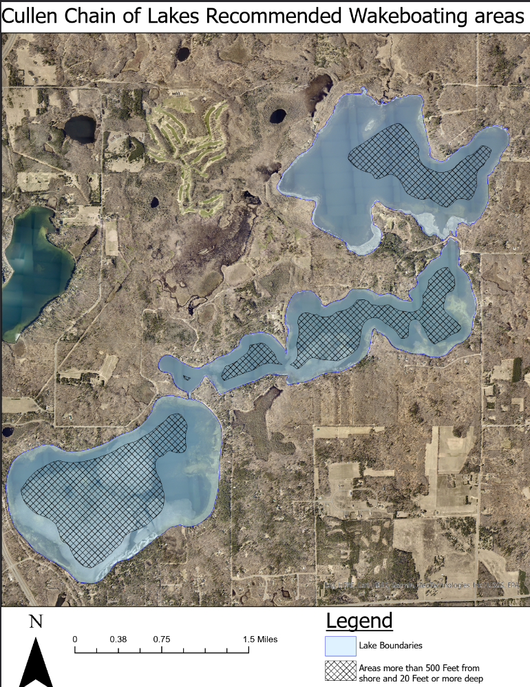
Lake maps that depict where wake surfing should primarily occur have become a thing in the last year.
The maps, which identify water that is at least 20 feet deep and 500 feet from shore, are viewed as an educational tool. Some experts – certainly not all – recommend wake surfing be limited to these areas to prevent undue shoreline damage and lakebed disruption. These recommended distances are based on research conducted by the University of Minnesota.
In the spirit of education, the CLA has obtained maps of all three Cullens that depict areas that are 20 feet deep and 500 feet from shore.
A few things to know.
One, the Minnesota DNR has not endorsed the 500 feet and 20 feet recommendations. The agency’s literature still recommends distances of 20 feet and 200 feet.
Two, the DNR has no immediate plans to implement stricter wake boat regulations. DNR Commissioner Sarah Strommen said this at a recent statewide lake association meeting. Basically, her message was that Minnesotans enjoy the outdoors in many different ways and her agency, at least now, isn’t interested in trying to legislate competing values.
Three, all boats can make waves and disturb lake bottoms. As such, we all need to be mindful about how we operate our boats. This is especially true at the upper end of Middle Cullen where starry stonewort exists and can be spread down-lake from excessive propwash.
Feel free to print these maps in the spirit of safe boating and shoreline protection.